
Coyote Creek Covered Bridge
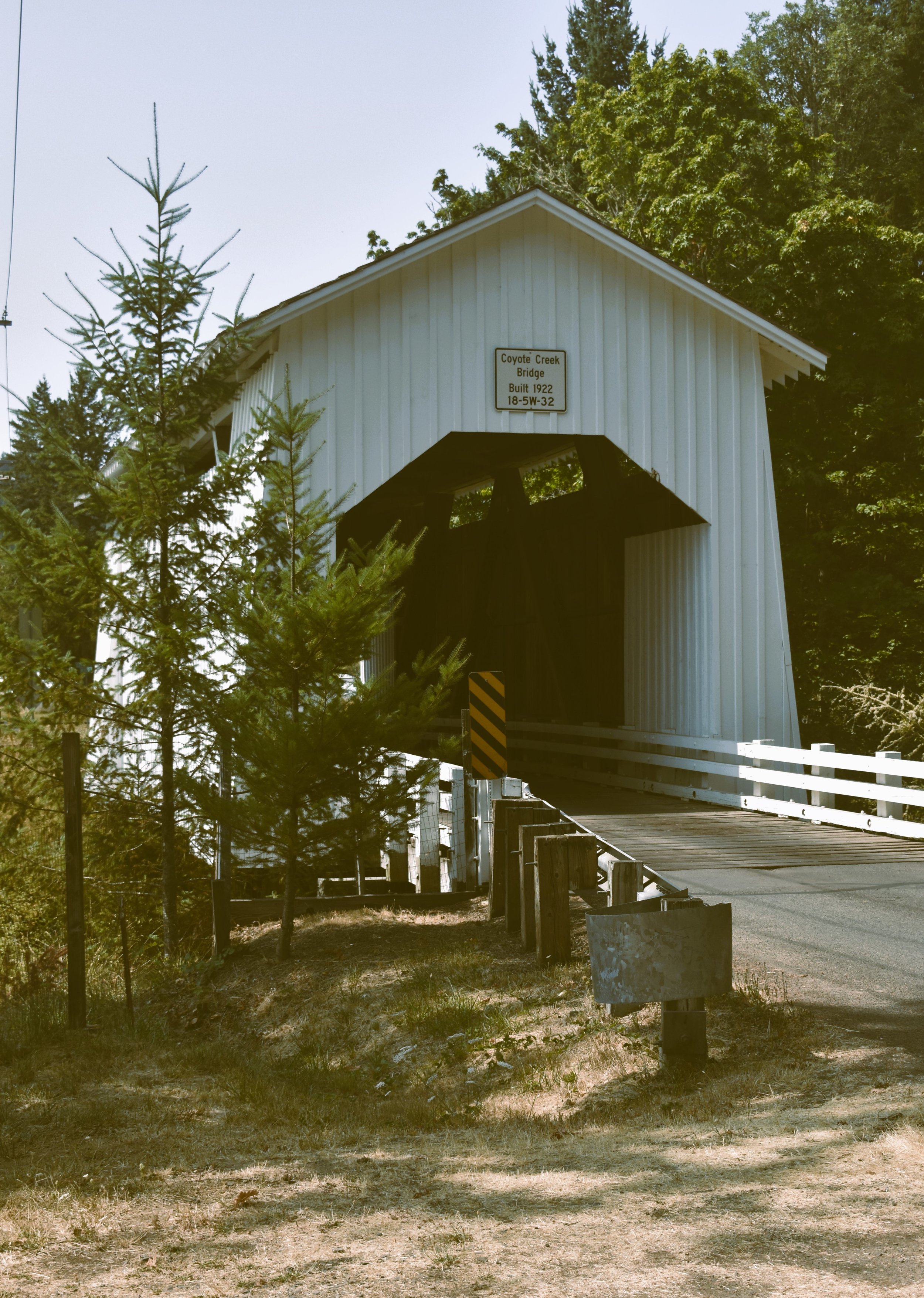
Coyote Creek Covered Bridge was built in 1922. This 101-year-old beauty is a 60-foot Howe-type truss. “It is not a true Howe design due to the lack of counter braces in the center panel” (2013, p. 132).
The bridge is south of Crow, Oregon as you travel on the Territorial Highway. The brige is “on the route of the original Territorial Road (1851)” (1985, p. 177). No, that is not the number of the road. It is one of Oregon’s oldest roads and can be traced back to 1851.


Nikon D3400 18 - 55 mm lens

Nikon Z5, 85 mm lens 100 ISO
Vintage filter applied to original image
Coyote Creek Covered Bridge is also known as Battle Creek or Swing Log. “The source and meaning of the name Swing Log are unknown, but intriguing, nonetheless” (1985, p. 177).

My 1985 guide shows rounded portal arches. Image with rounded portal
Covered Bridge Key
🚚Active Bridge - This is an active bridge with traffic (see photo gallery).
🛣️Road Side Parking - This is an active bridge without parking. One must pull off the road and engage hazard lights (see photo gallery).
🦌Watch out for deer on the road.
🗺️Limited internet. Travelers will want an old school map such as a DeLorme Atlas
➡️Bridges nearby - Wild Cat, Deadwood, and Lake Creek/Nelson Mountain.